|
Blog by David Mason, National Trust Ranger - Suffolk and Essex Coast ‘Increasing the extent and health of the saltmarsh area improves biodiversity and provides a range of other ‘ecosystem services’ (things that saltmarsh delivers for society) such as natural flood allevation, reductions in wave energy, spawning and nurseries for fish, providing food and shelter for birds, and locking up carbon dioxide to reduce the effects of climate change.’ I write this, the first Ranger’s blog from the Northey LOTE project, after visiting Northey Island on the Blackwater Estuary on the Essex coast. It was a bright November afternoon on a falling tide and as I approached the tidal causeway that links it to the mainland the last Lapwing and Dunlin were leaving the causeway to feed on the newly exposed mud. In the distance a flock of Golden Plover were glowing in the sunlight, reflected in the glistening mudflats. This is a spectacular place to see coastal birds when large flocks of waders and wildfowl gather on the estuary to feed and roost. Several years ago, I saw c.5000 Brent Geese land on a site on the Suffolk coast during an October storm as they came in to land for shelter, skein after skein, on their migration South. They left the next morning when the weather cleared and I wondered if I had dreamed it! I had heard that the Blackwater Estuary was a hotspot for them and have been delighted since starting work on the Essex coast last November to see where they were heading: Northey is a refuge for them in the winter where they roost and graze on the grass fields and on the saltmarsh as the tide comes up. In February I spent a happy morning clearing a footpath for the new circular visitor route we put in place this year, working with hand tools to minimise disturbance, while the geese chattered quietly in the field nearby. 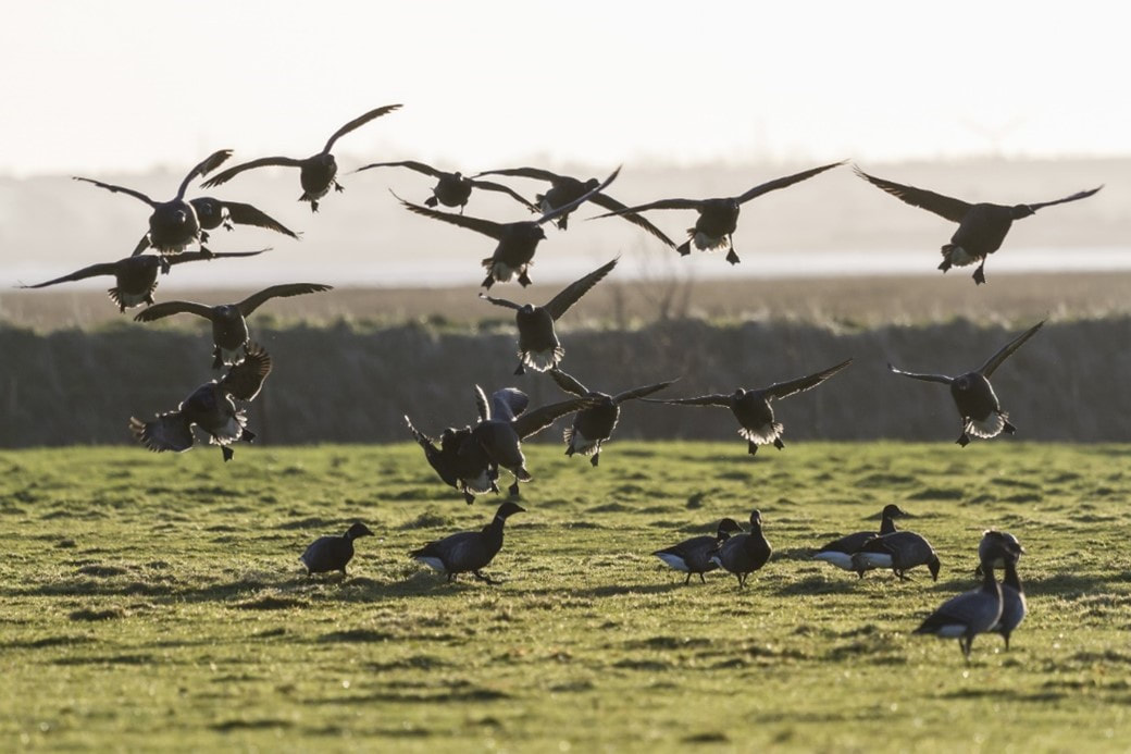 Brent geese by National Trust Images/Justin Minns I first visited the site in 2019 as the work to realign the South Embankment was being undertaken. This work was finally completed this year after delay in 2020. The mud from the embankment was placed in the ditch behind it (from where it had originally been dug in the mid-1800’s) to reform the natural landscape; the realigned area has now been naturally colonised by a wide range of saltmarsh species such as sea purslane, samphire, sea aster and sea beet as the tide has flooded the area, bringing in seed from the surrounding area. This area grades into a rising grassland bank which as sea levels rise will become new saltmarsh but now provides a rare transitional area between the saltmarsh and terrestrial grassland. Now the pressure of coastal squeeze has been reduced, it is also notable that the saltmarsh in front of where the embankment was (which was heavily eroded) is also showing some signs of recovery with sediment depositing and new saltmarsh vegetation growing. I am impressed at how quickly this has established from bare mud. Allowing the coastal processes to function naturally without the constraints of man-made structures seems to be key. There is an increasing urgency to carry out more of this work for nature conservation as existing saltmarsh is rapidly eroding due to sea level rise and coastal squeeze on saltmarsh between the tide and coastal defences. The island has been busy with contractors this year and new habitat and visitor facilities have been created and installed in preparation for future realignment of other embankments. Volunteers from the Essex and Suffolk National Trust group helped in maintaining the visitor route and picked up eight bags of litter from the foreshore. There are a small number of water voles that live a marginal existence on Northey Island. The water voles’ homes and their numbers here have recently suffered from flooding from the sea (such as in 2013 and 2017/18) and hot dry summers. Part of our work in adapting to climate change and sea level rise is to create a new watery habitat for them. A new pond and ditch system has been created on higher ground which will provide a safer, more sustainable future home for Water Vole. Coir rolls with pond plants embedded have been placed which it is hoped will provide food and shelter for the voles and other wildlife when they become established. This is overlooked by a new hide where visitors will be able to look over the pond, a new scrape and establishing saltmarsh. 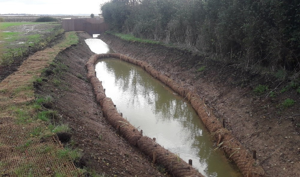 New pond and ditch system by National Trust Images/David Mason A new scrape created this summer has filled with water and is already attracting Lapwing, Teal and Curlew amongst others. 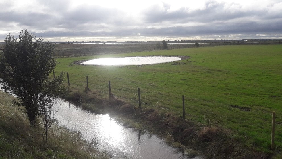 Newly created scrape by National Trust Images/David Mason In some areas dredged sediment from elsewhere in the estuary is being used to increase the resilience of the marsh. The adaptation of the coastal processes this achieves will prevent further erosion of saltmarsh in these areas. Eroded creeks that were bare mud a few years ago are already building up with natural silt deposited by the tide and recolonising with saltmarsh plants. The estuary side of the bank in this area includes some areas of shingle which provide another niche habitat and attracted 49 Ringed Plover in August, as noted on the regular bird (WeBS) count.
All in all it has been a fascinating year seeing the work progress and habitats develop and sharing it with visitors and volunteers and now you.
0 Comments
Blog by Audrey Jost - Assistant Warden at RSPB Seasalter Levels Seasalter Levels is an RSPB reserve located in the South East of England, north of Canterbury. Acquired in 2007, the Levels were first constituted of only one unit named LNR (Local Nature Reserve). Since then, thanks to the efforts of the Seasalter Partnership (comprising RSPB, Natural England, Canterbury City Council and Swale Borough Council), the Levels have expanded to include four new management units (Whitstable Bay Estate, Monkshill, Alberta and Vikings Estate), increasing its overall size from 71.5 ha to 290 ha. Constituted of mostly lowland wet grassland habitat, the Levels have, over the years, experienced a lack of appropriate management, leaving the area in poor condition for breeding waders and wintering wildfowl. 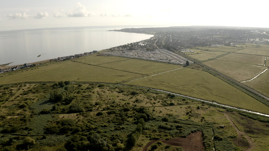 View of dry fields in Alberta in August 2021 . Photo Credit: RSPB/Jeff Kew Thanks to funding from the Green Recovery Challenge Fund and the EU LIFE project, a large-scale restoration project of 228 ha of the reserve was able to be put in motion. The project includes the creation of new topographic features aimed at improving the habitat for wildlife, particularly for wading birds such as lapwing and redshank, respectively classified as Red and Amber under the UK Red List for Birds (2015). Features created will help manage and retain water in fields, resulting in shallow pools with muddy margins that provide suitable habitat for wading birds to forage for invertebrates in soft, damp soils. The features include: Rills: Meandering channels varying in depth that retain water for a longer period than adjacent grassland. They are arranged in a branching structure supplying water from the perimeter ditches to the middle of fields. They also provide long muddy margins, increasing the feeding area for wading birds. Scrapes: Shallow depressions with irregular outlines and gentle slopes that seasonally hold water, supporting a rich invertebrate life. Ideal for redshank, that prefer shallow pools of water for feeding. Bunds: Acting as a barrier to minimise water runoff, earth bunds increase water infiltration in the soil. Long, ditch-side bunds also provide an opportunity for water vole colonisation by maintaining dry banks when the water levels are at their highest. Islands: Low, flat features that sit higher than peak water levels and provide refuge for waders and wildfowl from nest flooding and give safe spaces for winter roosting. The works, that officially started in September 2021, also include the creation and repair of crossing points and culverts to allow fine water level control. Ditch enhancements and reprofiling of existing banks will provide niche habitat for water voles and aquatic invertebrates. 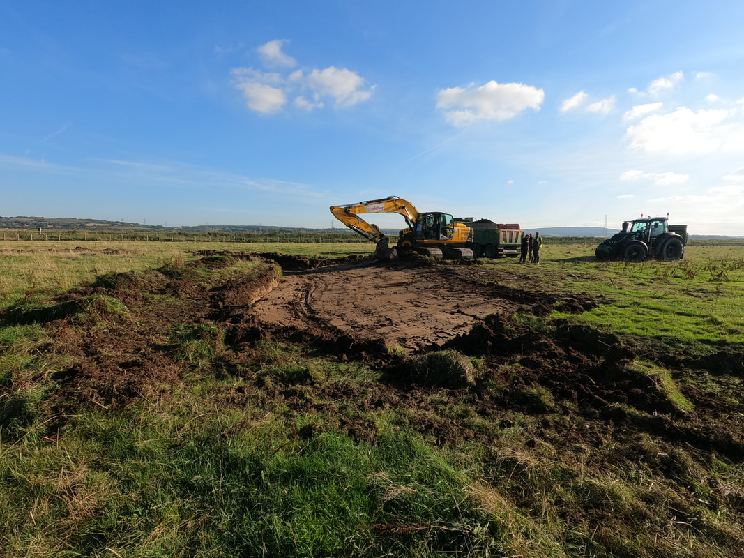 Creation of a rill in Alberta: after digging a small ditch that will become the centre of the rill, the slopes are being scraped from each side, giving the rill its completed shape. Photo Credit: Audrey Jost 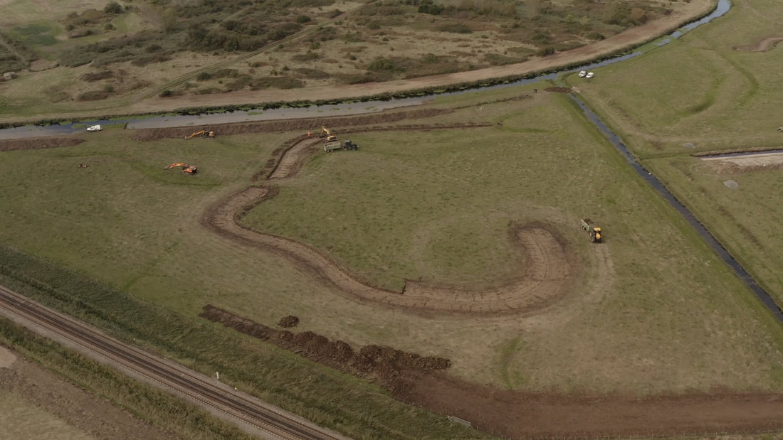 Bird's eye view of the ongoing work. Photo Credit: RSPB/Jeff Kew Whilst it is still a work in progress, changes on site are becoming more and more noticeable, and not only to the human eye! 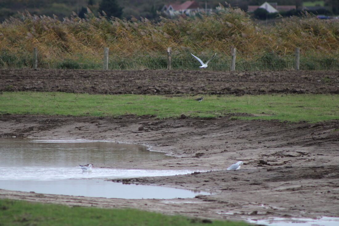 Black headed gulls in a newly created rill filled with rain water, with a lapwing in the background (Alberta, November 2021) Photo Credit: Audrey Jost To date, restoration work has been completed on two out of the four units. As we progress, we will start to introduce large scale grazing across the reserve that will entail the installation of gateways, fencing and a livestock corral. Grazing is an essential part of reserve management as a short grass sward gives ideal habitat for ground-nesting lapwing. By grazing with cattle and flooding the fields, new plant communities will develop, including wildflowers such as red clover that provide a nectar source for bumblebees like the endangered shrill carder bee, which has a local population on the nearby sea wall. Further updates will come as work continues. |
|
Project LIFE on the edge: improving the condition and long-term resilience of key coastal SPAs in S, E and N England is supported by the LIFE Programme of the European Union
|
LIFE19 NAT/UK/000964
|