|
Blog by David Mason, National Trust - Suffolk and Essex Coast Ranger ‘Working with the grain of nature yields the best chance of maintaining a healthy and beautiful coast for the future, a coast that is great for people and for wildlife.’ – Northey Island Coastal Adaptation Strategy Project Vision The UK government has recognised the importance of the East Atlantic Flyway, a migratory bird route over western parts of Europe including Yorkshire, Lincolnshire, Norfolk, Suffolk, Essex and Kent. In recognition of its vital importance to bird populations and wildlife it has joined the list of seven sites put forward to join the list of World Heritage sites. The area sees huge transient bird populations pass through every year as the seasons change, and the River Blackwater in Essex, including Northey Island, is one of its hotspots. More space created for birds. The overhead powerlines across the island were removed last year and replaced with underground cables. Once the flightline was clear the brent geese that winter here, along with lapwing, curlew and godwit, began using the eastern and southern field, areas of the Island they had previously avoided. The highest number of geese since 2015 (1710) was recorded on the WeBS count, along with the highest count ever of dunlin (3875) roosting at high tide. 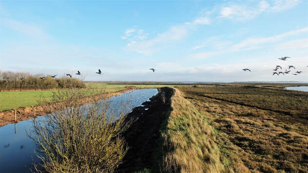 Brent Geese flying in to Northey Island (c) National Trust 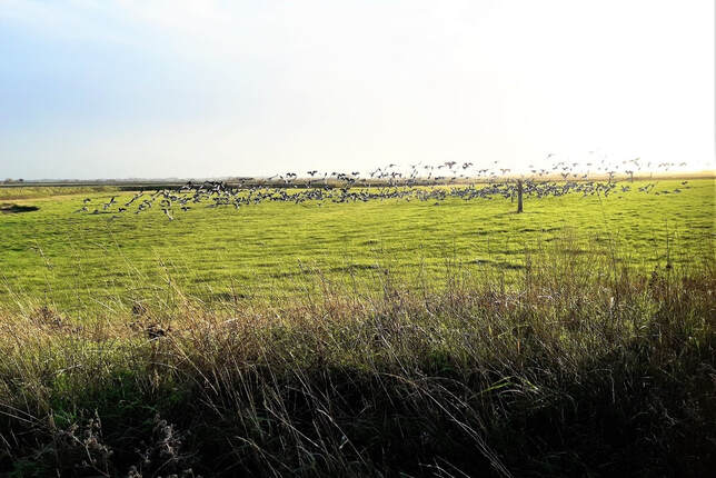 Brent geese settling near the removed powerline (c) National Trust Following the managed realignment, this area in the eastern field is designed to be underwater at high tide. It will retain water when the tide goes out and will develop as a saline lagoon. The geese enjoyed the shelter of the sea wall over the winter and used all the grassland on the island. 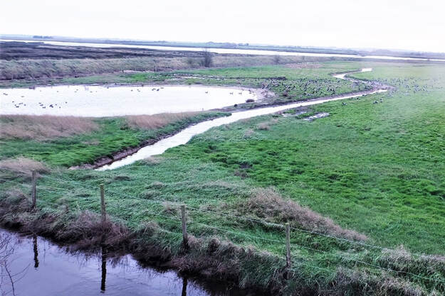 Brent geese resting on the realignment area (c) National Trust North West Wall beneficial use of dredged sediments (BUDS) Further sediment dredged from Maldon harbour has been placed to enhance the saltmarsh in this area as part of an ongoing project. 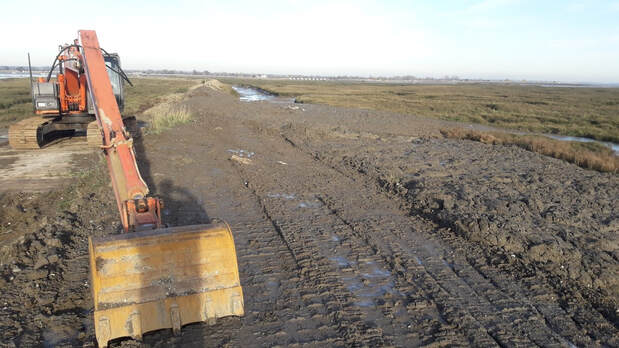 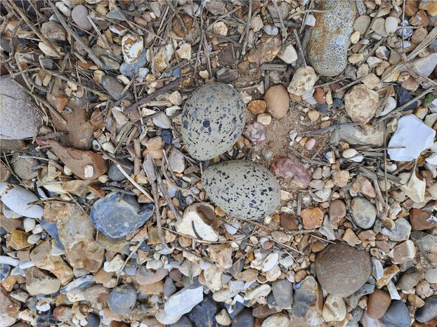 Oystercatchers nested just beyond the placed mud on a patch of gravel. We are hoping other birds may use the new nest boxes placed on top of the cut down power poles left in the eastern field.   Water vole update Pond marginal vegetation is well established in the main new pond and is providing food and shelter for the translocated voles. A pair of mallard also nested in the vole enclosure and hatched 10 ducklings. 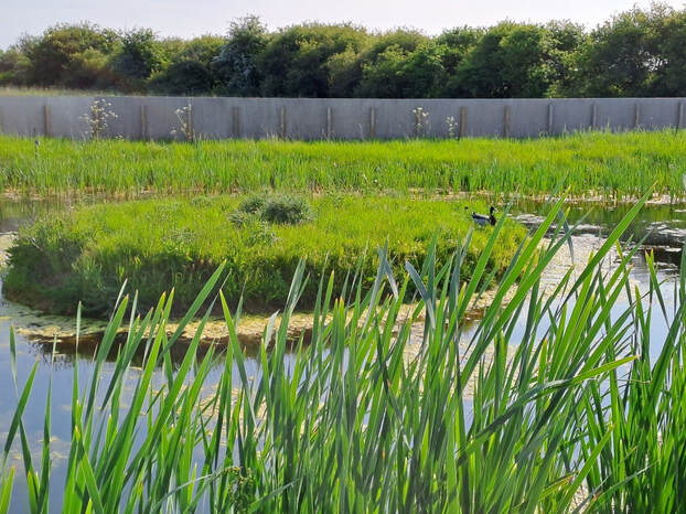 Signs of water voles burrowing in the pond banks and feeding have been found with the characteristic diagonal cut on the small piles of vegetation. Later in the year they will pull these into their burrows as a winter food source. 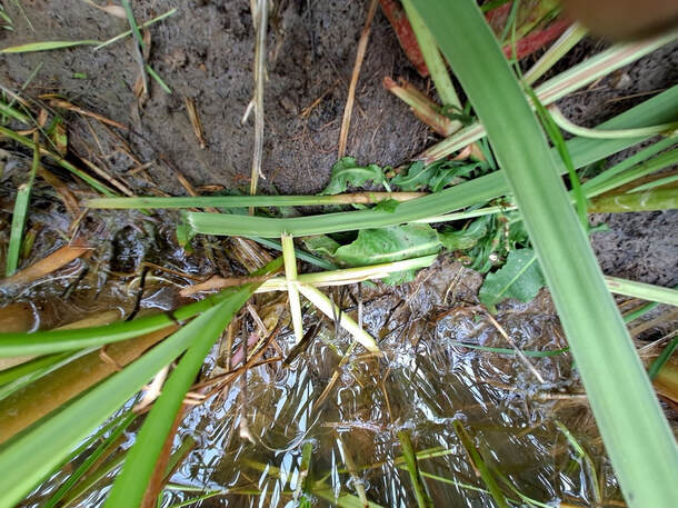 A new extension fence has been installed along a connecting ditch to allow population expansion and accommodate any further voles found during the continuing works. The fencing installed to contain the voles will be removed when the works are finished, and they will have access to all the freshwater bodies on the island. 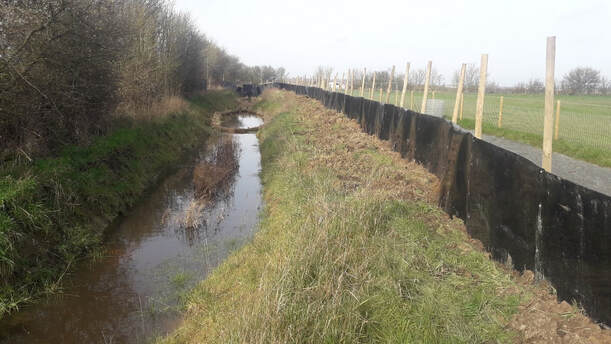 Telling the story of Saltmarsh, Migration and Managed Realignment New interpretation boards have been installed in the hide and on a viewing platform, with a a new bench overlooking the River Blackwater towards Maldon and Heybridge. The three boards illustrate different aspects of the island’s environment. The first board explains the importance of saltmarsh for biodiversity, flood protection and carbon storage and the second highlights the East Atlantic Flyway used by migratory birds. The third board illustrates the work of the LOTE project to realign some of the sea walls to create 10 hectares of new saltmarsh and protect 50-60 hectares of saltmarsh for the next 100 years, predicted to have been lost to the effects of climate change without action. 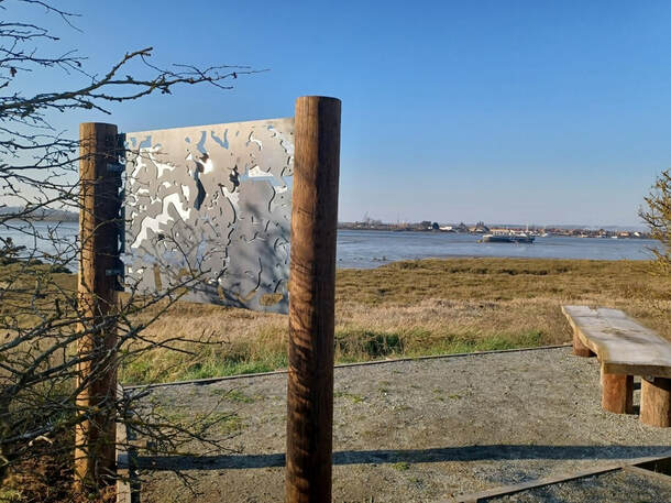 Interpretation board on the new viewing platform. This board has a steel base cut in the shape of the Northey saltmarsh, as seen from the air (c) National Trust 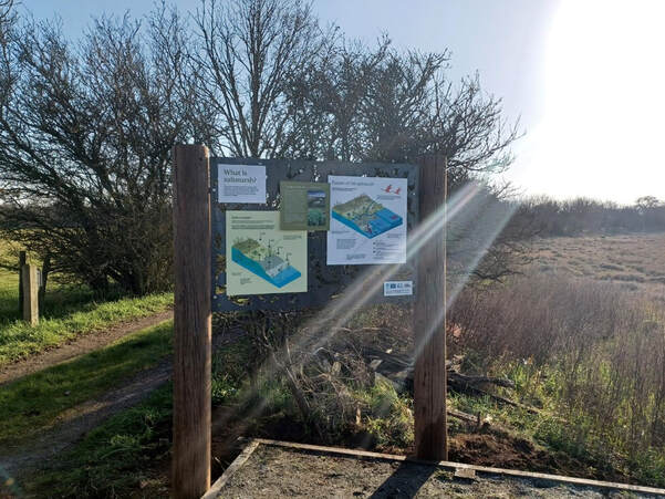 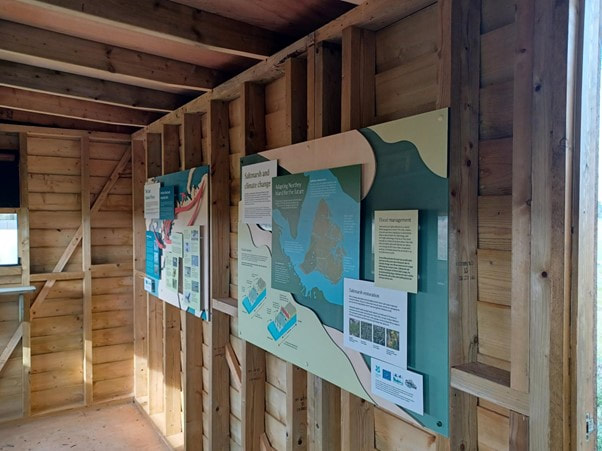 Another new hedge and pond created 276 hedge plants were planted in total and included hawthorn, hazel, wild honeysuckle, spindle, field maple, buckthorn, hornbeam, cherry plum and blackthorn. These species were selected to provide a good variety of fruit, blossom and year-round interest, so will hopefully increase the food sources available for birds and insects on the island. These have been weeded and mulched by the Essex and Suffolk Volunteer Group along with removing old barbed-wire and litter from the saltmarsh. Three new ponds have been created, linked by a connecting ditch, in the north east corner of the island. They have attracted yellow wagtail and mallard. 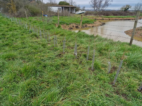 Links to previous blogs about Northey Island
Part 1: www.projectlote.life/news/northey-island Part 2: www.projectlote.life/news/ntconservationadaption Part 3: https://www.projectlote.life/news/ntwatervoles
0 Comments
|
|
Project LIFE on the edge: improving the condition and long-term resilience of key coastal SPAs in S, E and N England is supported by the LIFE Programme of the European Union
|
LIFE19 NAT/UK/000964
|